Airport Landscape: Altitudes of Urbanization
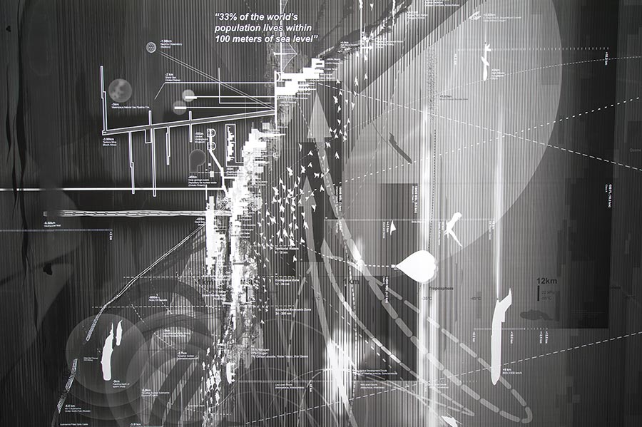
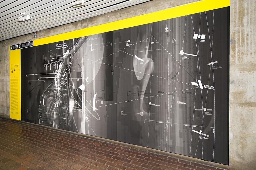
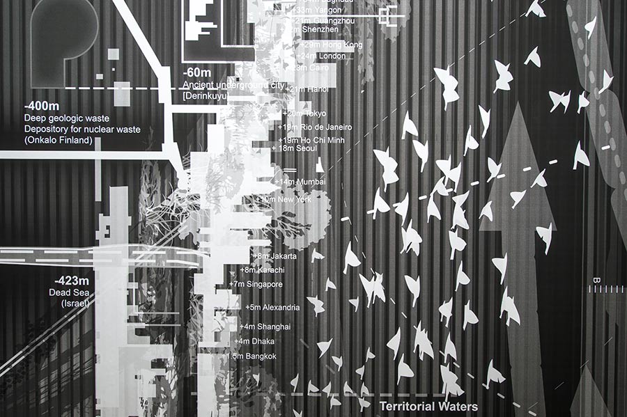
From 10,000 metres below the sea, to 35,000 kilometers in orbit above the surface of the earth, the infrastructure that supports urban life has reached unimaginable extents below ground, in the water, and across outer space. Re-profiling the conventional contours of the cities we live and the spaces we travel through, this diagram illustrates the range of depths and dimensions that we have reached and explored over the course of the past 3000 years. Referencing John McHale’s canonical drafting of Vertical Mobility in his 1969 The Future of the Future and Patrick Geddes’ 1909 Valley Section of Civilization, this visualization shifts our predominantly static and technological view of the world from above, to open a longitudinal lens on the processes and patterns of contemporary urbanization across three horizons: the orbital, the subterranean, the submarine. Across time, this deep sectional view brings to a light the inseparability of environmental forces and flows, climates and temperatures, pressures and atmospheres that regulate a range of senses, sites, systems and infrastructures. Here, in this field of motion and landscape information, multiple grounds are revealed as index and interface: a registration of existing temporalities, shifting territories and emerging agencies. This longitudinal landscape provides an augmented understanding of where we live in relationship to thermodynamic exchanges, latitudinal variations and hydrological ranges that are associated with vectors of movement—from logistics to communications, policies to legislations, planetary processes to intertidal cycles, climatic differences to barometric pressures, to better understand the live, dynamic ecologies under the influence of, and exerting pressure on, the altitudes of contemporary urban life.
—Pierre Bélanger, curator