Responsive Topography Fluvial Landscapes
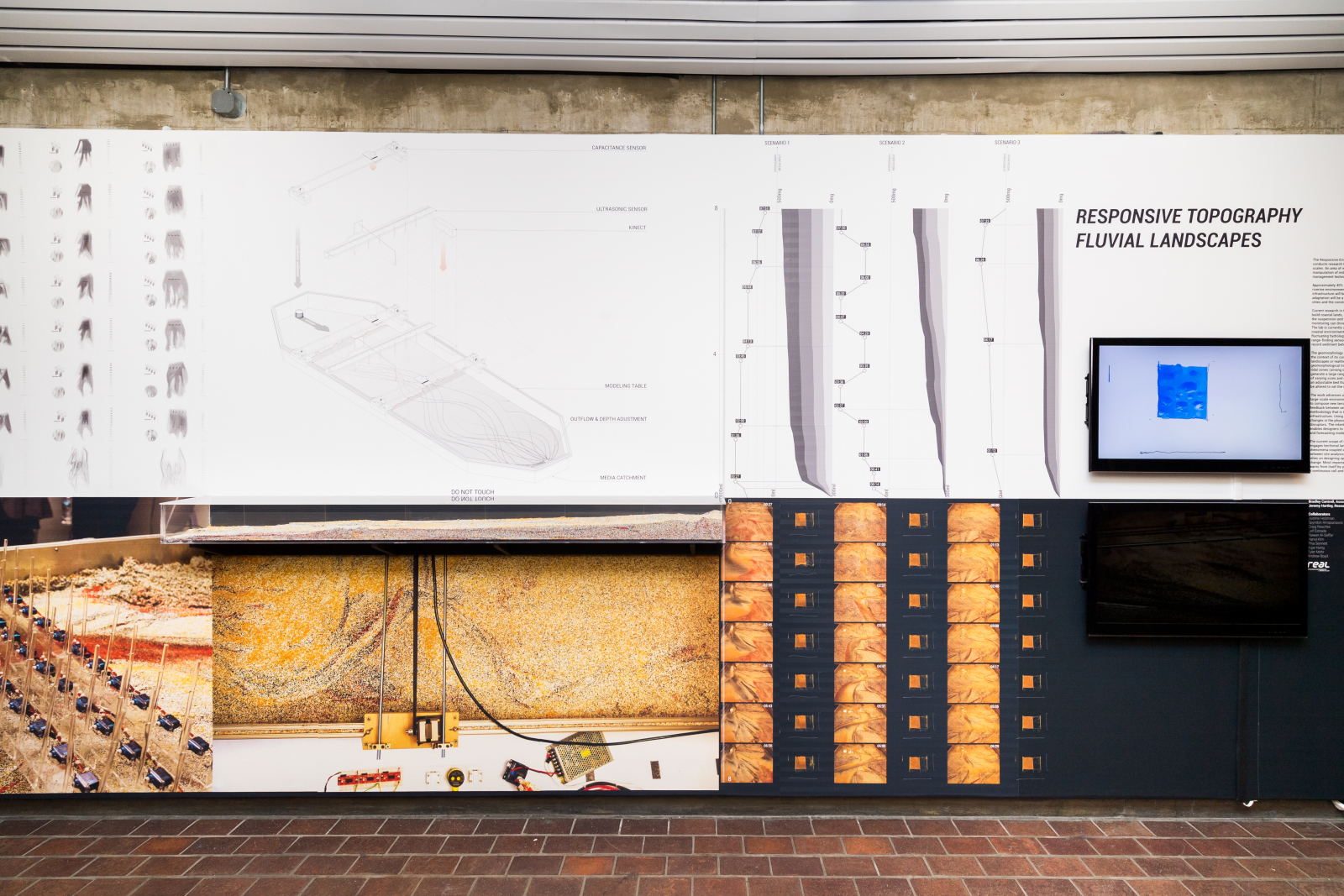
The Responsive Environments and Artifacts Lab at the Harvard Graduate School of Design conducts research that examines the potential of responsive technologies across a variety of scales. An area of research examining systems at the territorial scale, focuses on the manipulation of indeterminate land building using real-time sensing, robotics, and adaptive management techniques.
Approximately 40% of people across the globe are living within 100 kilometers of coastal and riverine environments. This means that three-quarters of the world’s megacities and critical infrastructure will be required to adapt to rising sea levels over the next century. This adaptation will be a monumental task, requiring huge adjustments in the physical location of cities and the construction of new infrastructure.
Current research in the lab posits that the energy, embodied in the hydrological systems that build coastal lands, can be choreographed. The work primarily focuses on sediment transport, the suspension and movement of sediment within the water column, and how sensing and monitoring can drive small modifications in the water system to construct or deconstruct land.
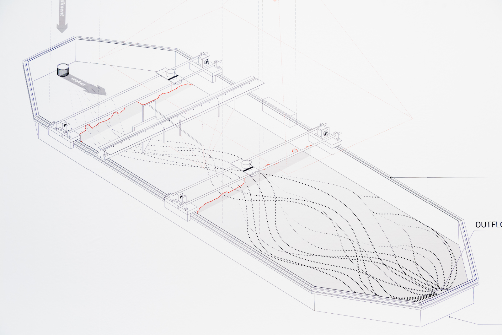
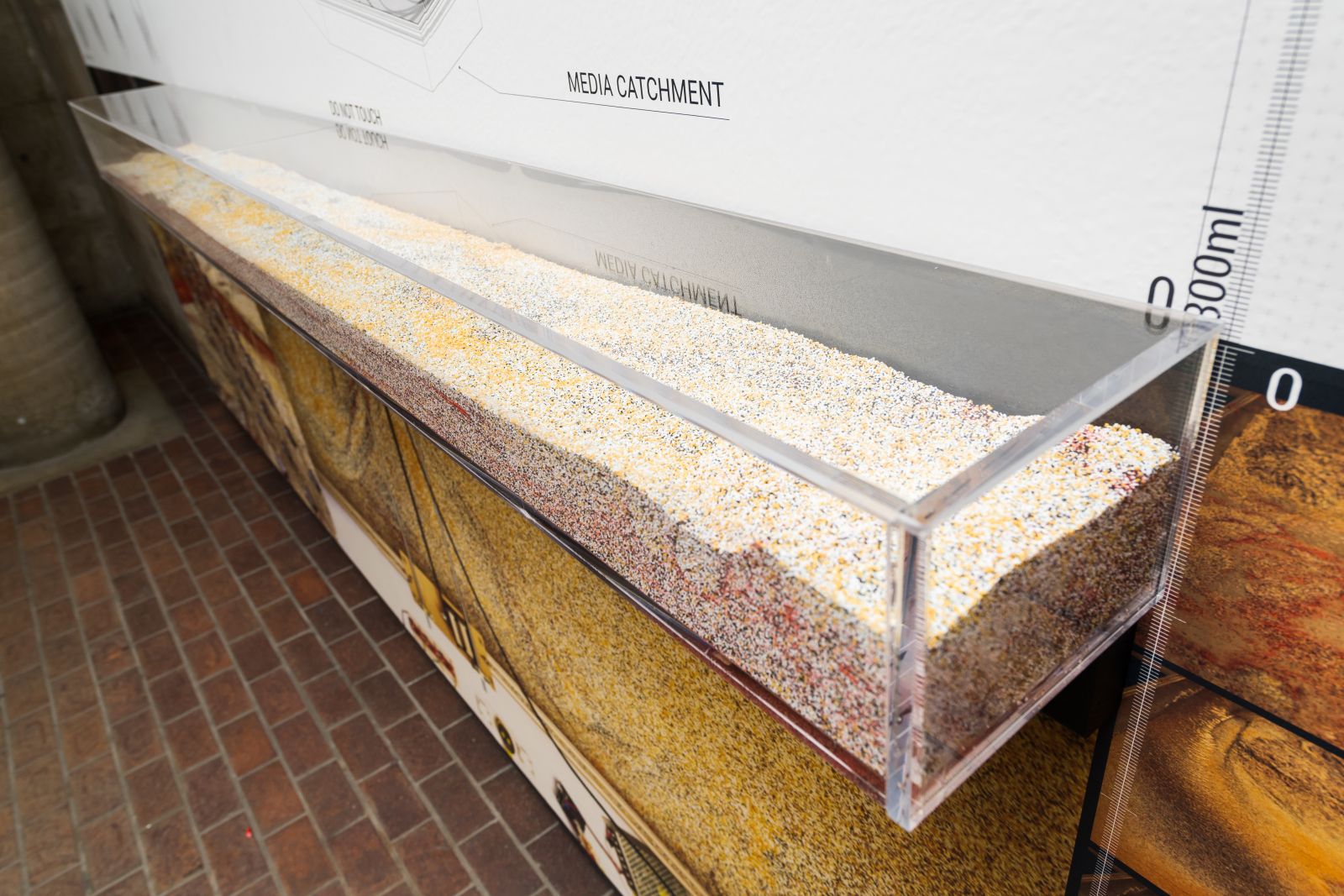
The lab is currently using a geomorphology modeling table to simulate dynamic riverine and coastal environments. This is the site where we begin to develop novel approaches to a fluctuating hydrology. The lab has created four sensing systems that use ultrasonic range-finding sensors, real-time photogrammetry, image analysis, and capacitance sensors to record sediment behavior, surface morphology, and water flow. The geomorphology model is imagined as its own space, with dynamic phenomena, unique to the context of its conditions. This allows the model to be free to simulate non-specific physical landscapes or realities. There are baseline conditions derived from prototypical
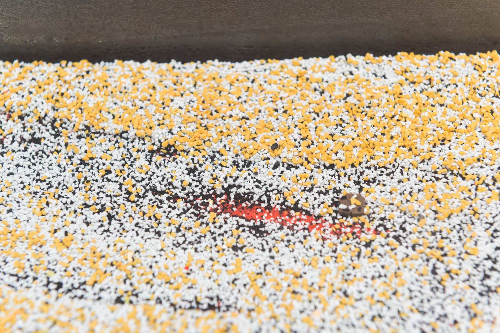
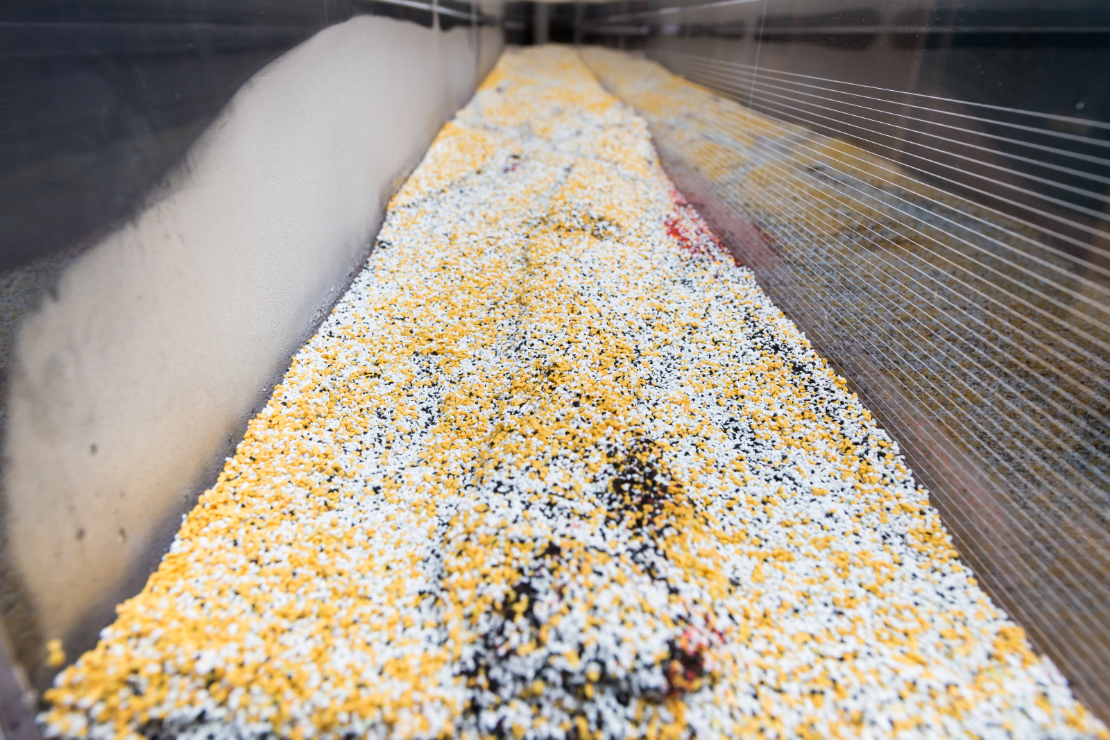
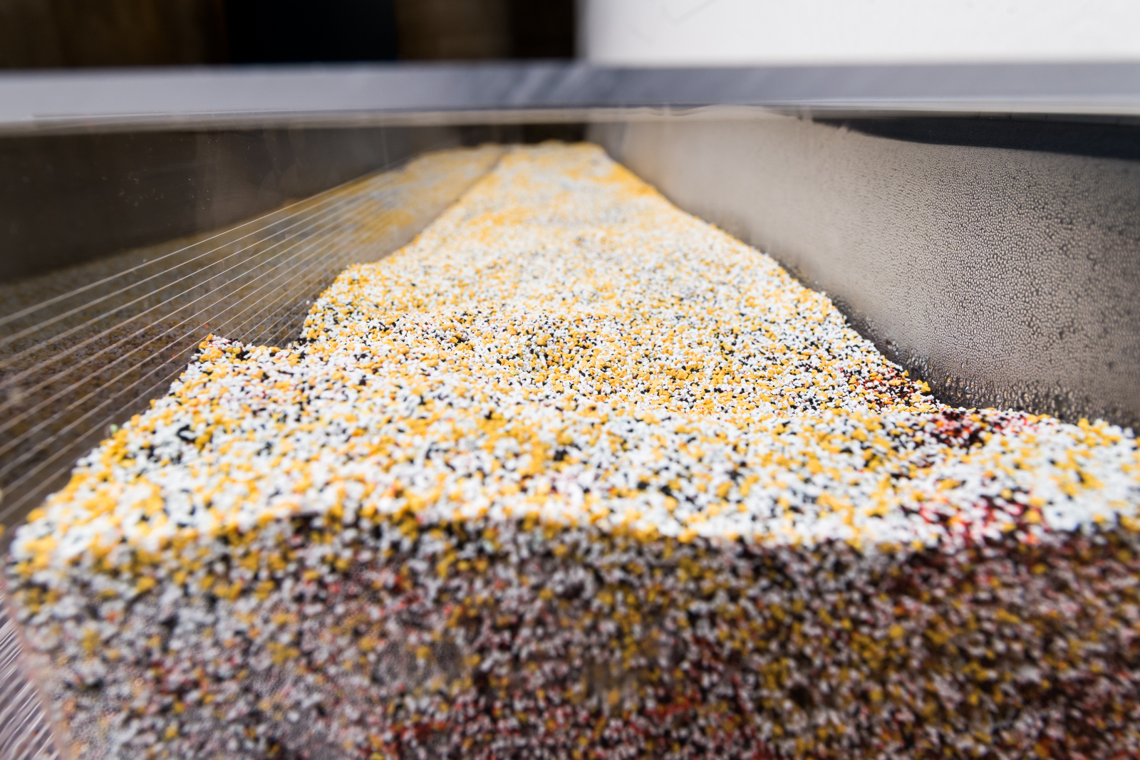
geomorphological tropes, such as delta buildings, meandering rivers, backwater swamps, and tidal zones (among others). The modeling space creates a tangible environment that can generate a large range of conditions. These conditions are created using a synthetic sediment of varying sizes and densities, water pumps that create stream flow and groundwater flow, and an adjustable bed that can set lateral and longitudinal slopes and depths. These variables can be altered to set the initial conditions as well as conditions controlled over time.
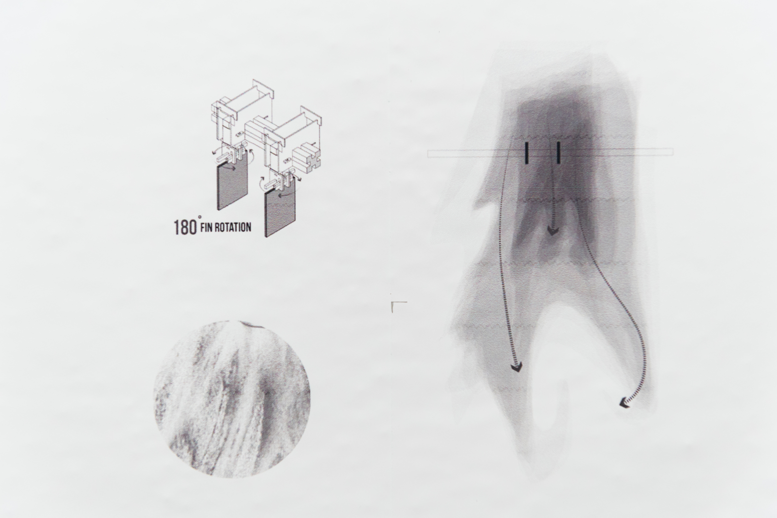
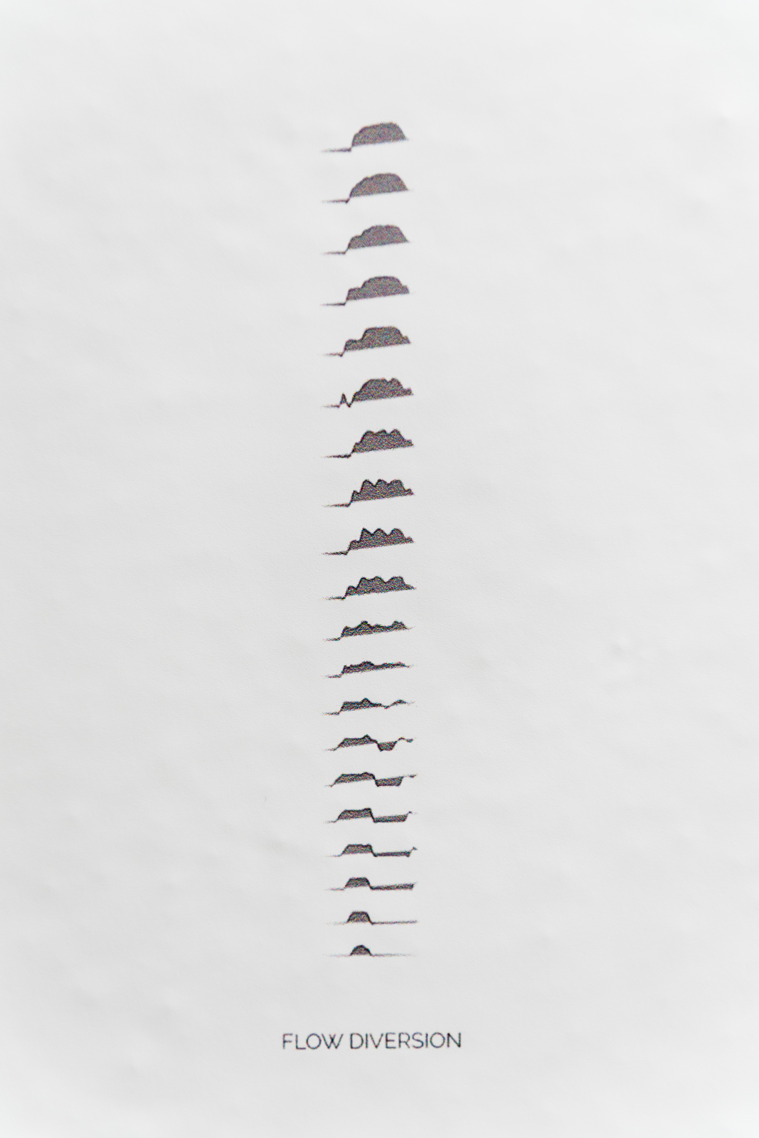
The work advances a form of design research that holds great promise for how we engage large-scale environmental change. Engaging highly dynamic systems and utilizing their energy to compose new terrains provides a mechanism for massive change with minimal input. The feedback between sensing systems and landscape modifications forms a construction methodology that is tunable and capable of challenging complex simulations and static infrastructure. Using the real-time digital models, the lab is creating devices that respond to changes in the physical model such as robotic sediment gates, repositionable sieves, and flow disruptors. The intent of this exploration is to develop prototypes and a design language that enables designers to create novel hydrologic landscapes that are tied to sensed phenomena and forecasting models. The current scope of work in the lab provides proof of concept for an emerging toolset that engages territorial landscape systems. This toolset relies on real-time sensing of landscape phenomena coupled with a process of adaptive management to produce closer relationships between site analysis and methods of construction. Conceptually, this proposes a method that relies on designing operations that intervene locally but aggregate to produce territorial change. Most importantly, this process is a form of landscape choreography that continually learns from itself by processing the results of its actions before choosing the next intervention. A continuous call and response between biological systems and an active infrastructure.