Climate Dense[city]: Building TOD on Higher Ground in Allapattah
by Kenner Carmody (MDes ’19, Energy & Environments)
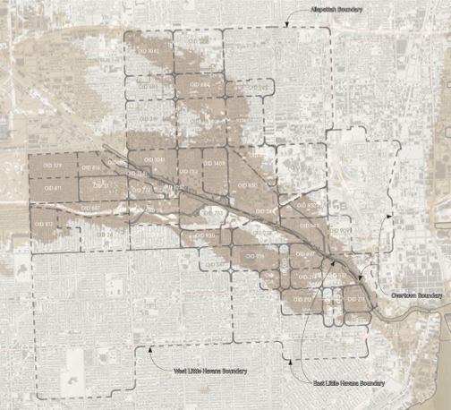
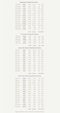
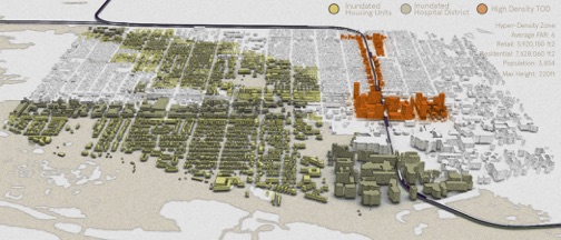
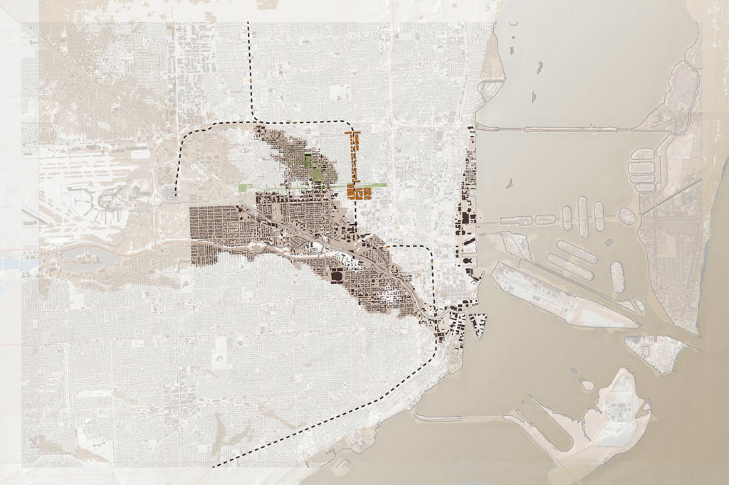
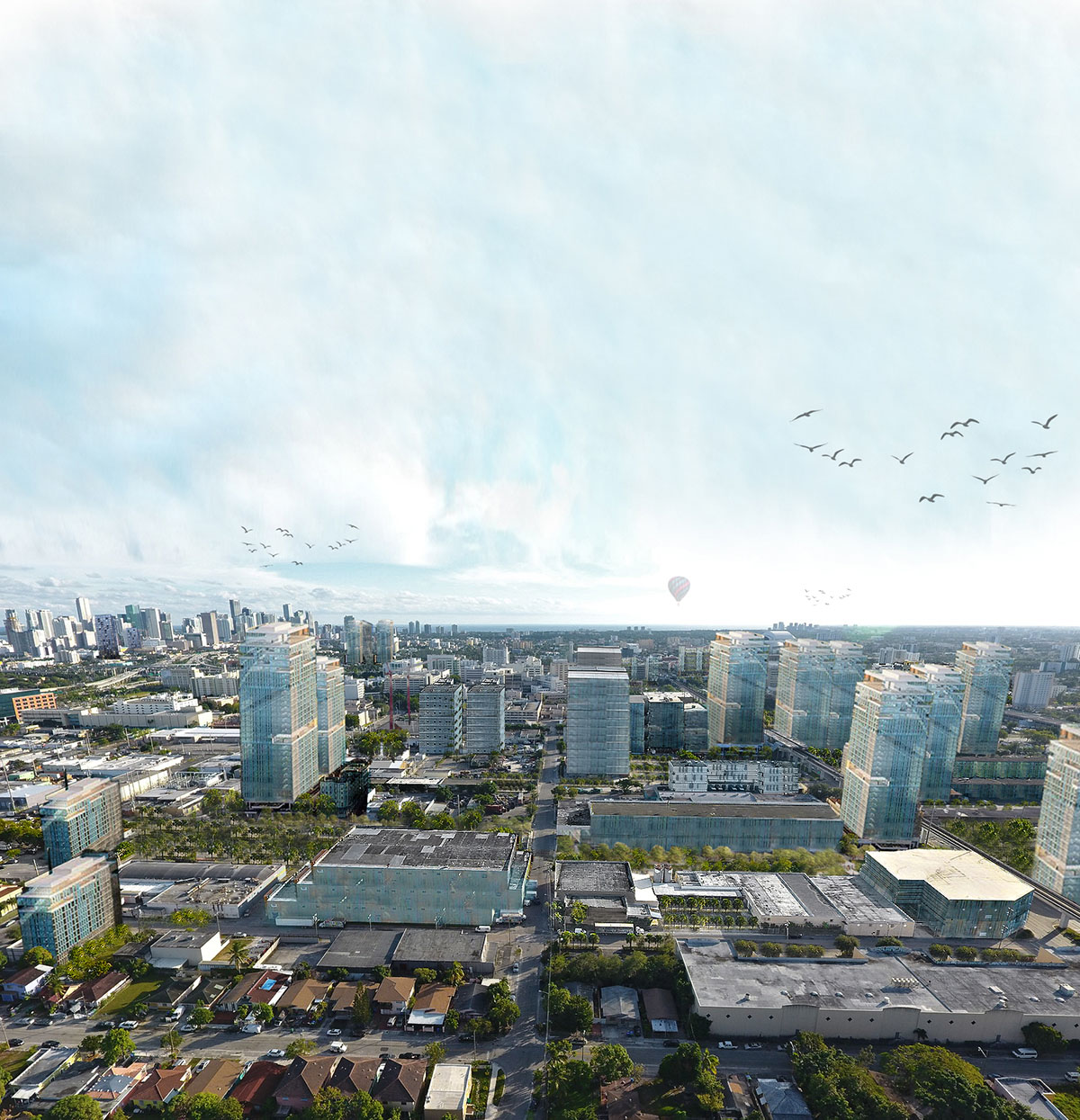
This research aims to visualize the required future housing stock necessary to accommodate displaced populations in Miami’s Allapattah neighborhood which will be affected by sea level rise and tidal inundation by the year 2100 (NOAA Office for Coastal Management). Property data, topological maps and NOAA sea-level rise projections are used in order to propose greater density in the City of Miami due to lost surface area around the Miami River. This study evaluates the existing spatial capacity and density distribution under current zoning policy, Miami 21. This study reveals that the current zoning code, overlay districts, and Neighborhood Development Zones (NDZ’s) within the population catchment area of Allapattah are maladaptive and should be completely reconsidered. Sited along Miami’s legacy metro system, a densification proposition in East Allapattah tests the hypothesis that a densified urban zone along underutilized existing transit infrastructure can accommodate new (and equitable) densities in Allapattah where housing, employment and amenities can cluster.