Creating Higher Ground in Boston’s Seaport
By Amelia Muller (MUP ’20)
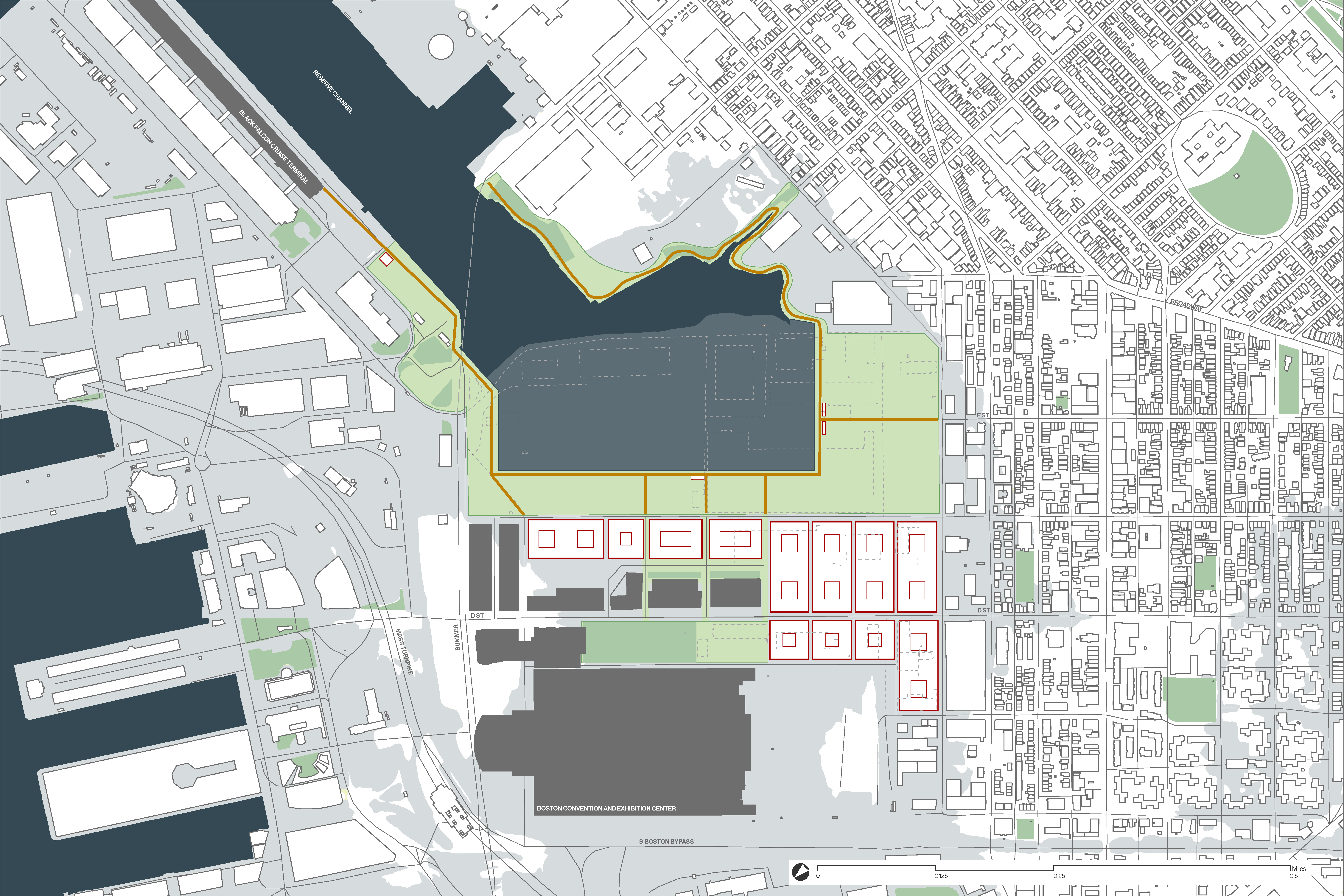
In September 2018, the City of Boston published estimates projecting the city’s population will reach almost 760,000 people by the year 2030. To meet the population growth and requisite housing needs, Boston has increased its overall housing goal to 69,000 units by 2030. Siting that growth requires significant land capacity in a city that is already land strapped. The industrial land between the Seaport and South Boston, east of the Boston Convention and Exhibition Center, represents a prime opportunity for development of new housing and amenities to serve those residents. However, this plan area and much of the surrounding land is under serious threat of sea level rise, projected along a similar timeline to population growth.
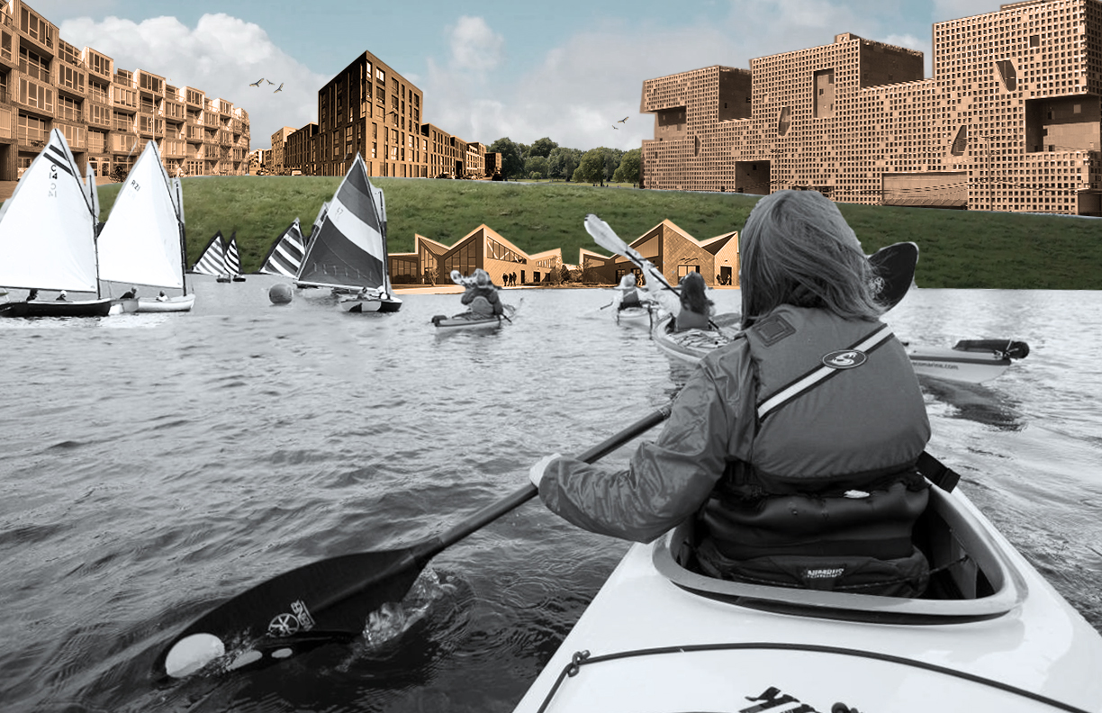
To develop housing in this area without addressing the threat of sea level rise would be deeply irresponsible. Thus, this plan seeks to create higher ground for development through “cut-and-fill” of the Reserve Channel and the inclusion of mediating green space between new development and the water. In addition to mitigating the harmful effects of climate events, this landscape will create a more enticing arrival experience from the nearby cruise terminal, provide a respite from the Boston Convention and Exhibition Center, and build on the success of Lawn on D to create vital open space for the Seaport and South Boston.
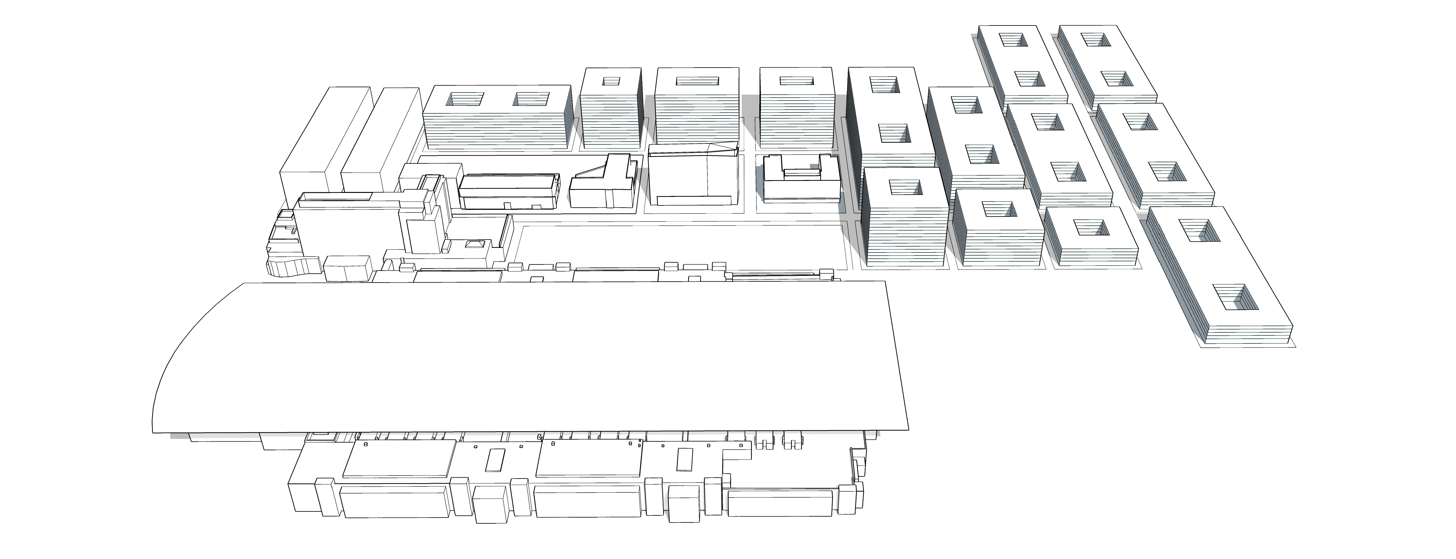
The density scheme proposed in the plan seeks to mediate the superblocks and higher heights of the Seaport with the lower heights of South Boston through a step-down approach from north to south.