Productive Conservation: Utilizing Landscape Ecology and Precision Agriculture Towards Land-Water Conservation
PLANT TOOLKIT. Cataloguing herbaceuous covers, shrubs, and trees that ecologically complement cash crop cultivation.
by Sourav Kumar Biswas (MLA ’16) and Flavio Sciaraffia (MLA ’15) recipients of American Society of Landscape Architects 2015 Student Award
Agriculture today has evolved into the most resource consumptive and environmentally disruptive human activity. It consumes more than 70% of the world’s water and contributes to 92% of Mexico’s water footprint. Modern agriculture is sustained by enhancing degraded soils through irrigation and fertilizers – transforming a vital resource into a mere substrate that receives abstracted water and artificial nitrogen derived from fossil fuels: food production and energy yields are no longer bounded to the ground.
At the same time, with the advent of precision farming, agriculture has also become a highly monitored and digitized activity. Our design strategy harnesses the potential of current agricultural tools to expand the ecological potential of productive landscapes on a regional scale by designing precise planting / management patterns that produce 4-dimensional spatial experiences.
A site that sits at the intersection of big-box logistics and agricultural fields is designed as a testing ground for models of precision conservation. Our project addresses the following question: How might the combination of ecological principles such as agro-forestry, inter-cropping, successional dynamics and precision farming tools such as multi-spectral mapping, agricultural printing, and smart machines, provide a template for a productive conservation strategy that is scalable and resilient as we enter the uncertain era of water-scarcity, climate change, and overall soil degradation?
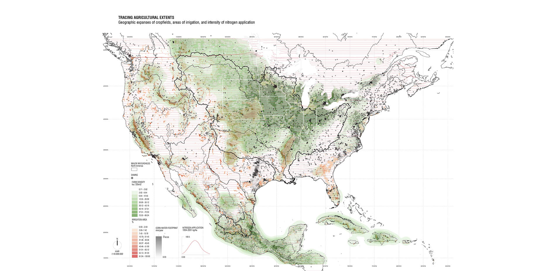
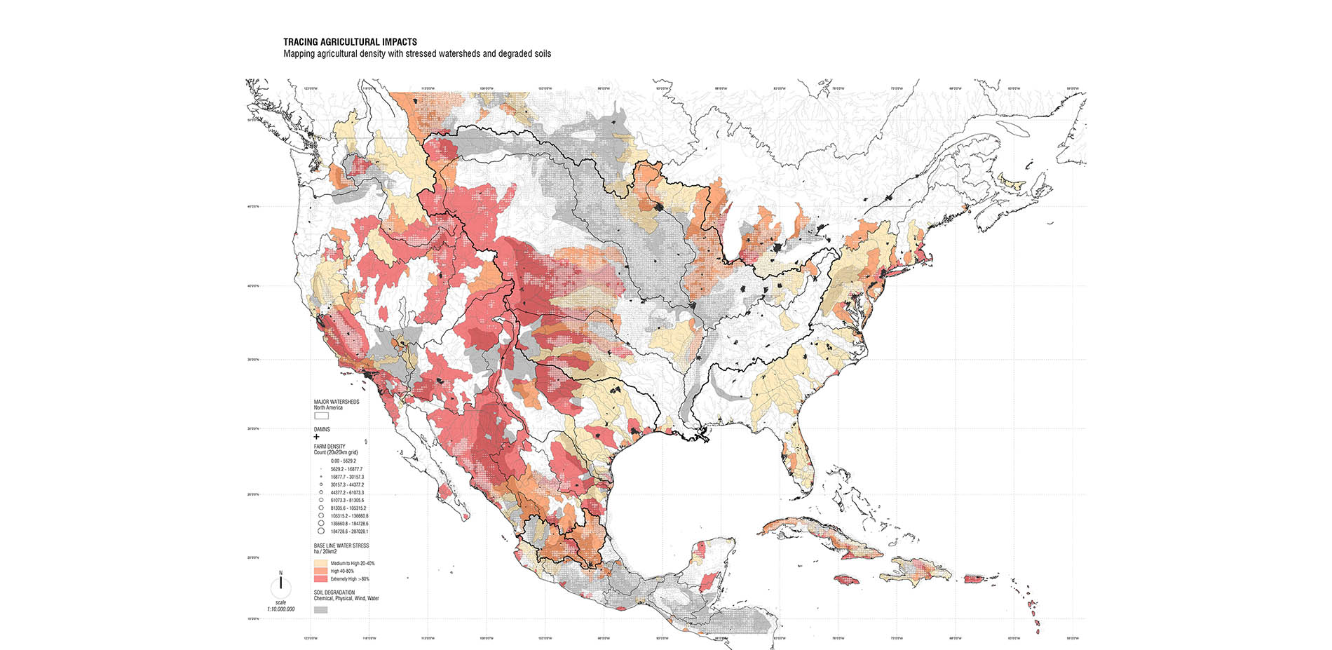
The project analysis began with the stacking of global datasets on agricultural production, and environmental indicators to reveal the extent and impact of agriculture on the land. Food is elusive, as it is embedded in logistical chains that do not reveal the source landscape. Nevertheless, agricultural products can be geographically traced and spatially defined as an index of water footprint, fertilizers application, irrigation infrastructure, and indexes for land degradation and water stress. Zooming in into the regional scale of North America, reveals extensive landscapes in which soil and water degradation is closely related to monocultures and industrial agriculture. Water infrastructure as well as the provision of fuel-based fertilizers has allowed a geographical transfer of agricultural production to the west of the 100 meridian into arid ecosystems. While most climate change predictions indicate increased and extended periods of droughts in Central Mexico and also south and north of the border with the US, the need for new models of soil conservation in productive-agricultural lands, becomes critical.
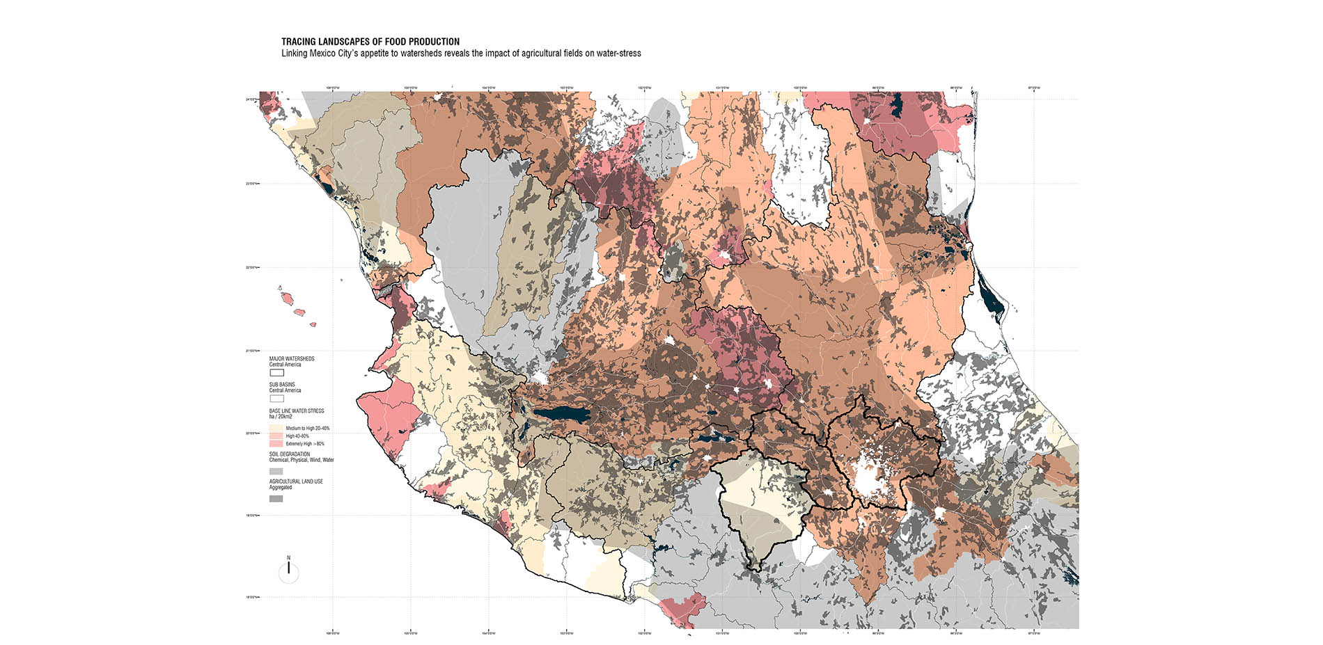
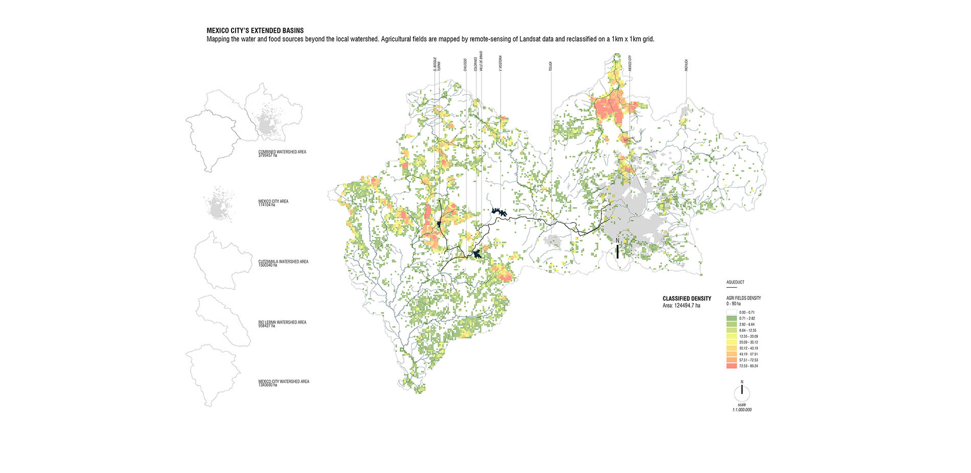
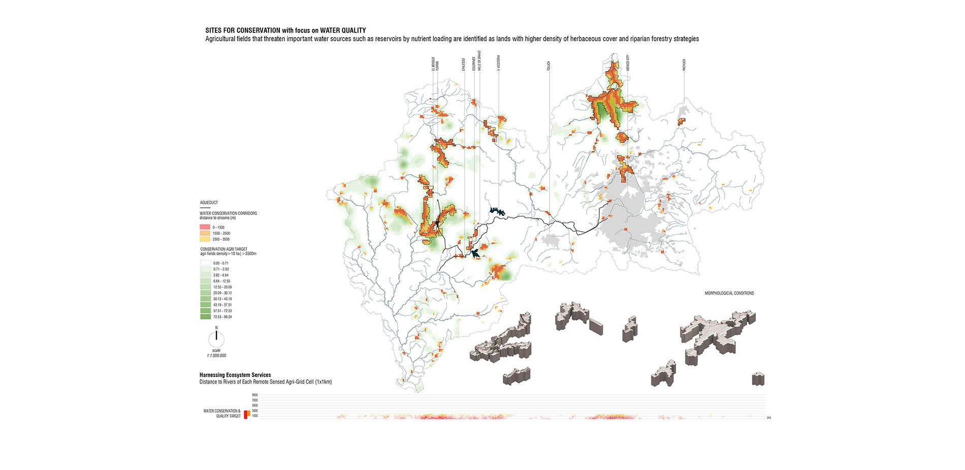
These regional relationships affecting land-water sustainability are best viewed within their respective watersheds. Thus, when we zoom into the Mexico City area, we understood that the city’s demand for agricultural products and even water is met by fields and reservoirs outside the city’s immediate watershed. Both food and water security are therefore interlocked in a delicate balance. Industrial monocultures degrade soil, demand excess water and decrease biodiversity. Further, the forests, rivers, and reservoirs that sustain the Mexico City region are threatened by agricultural encroachment or the effects of nutrient loading via runoff. The intersection of the water system with agricultural production extending over three watersheds, becomes the setting for our regional conservation strategy, in which site specific design can be upscaled to trigger positive ecological impacts on the regional landscape.
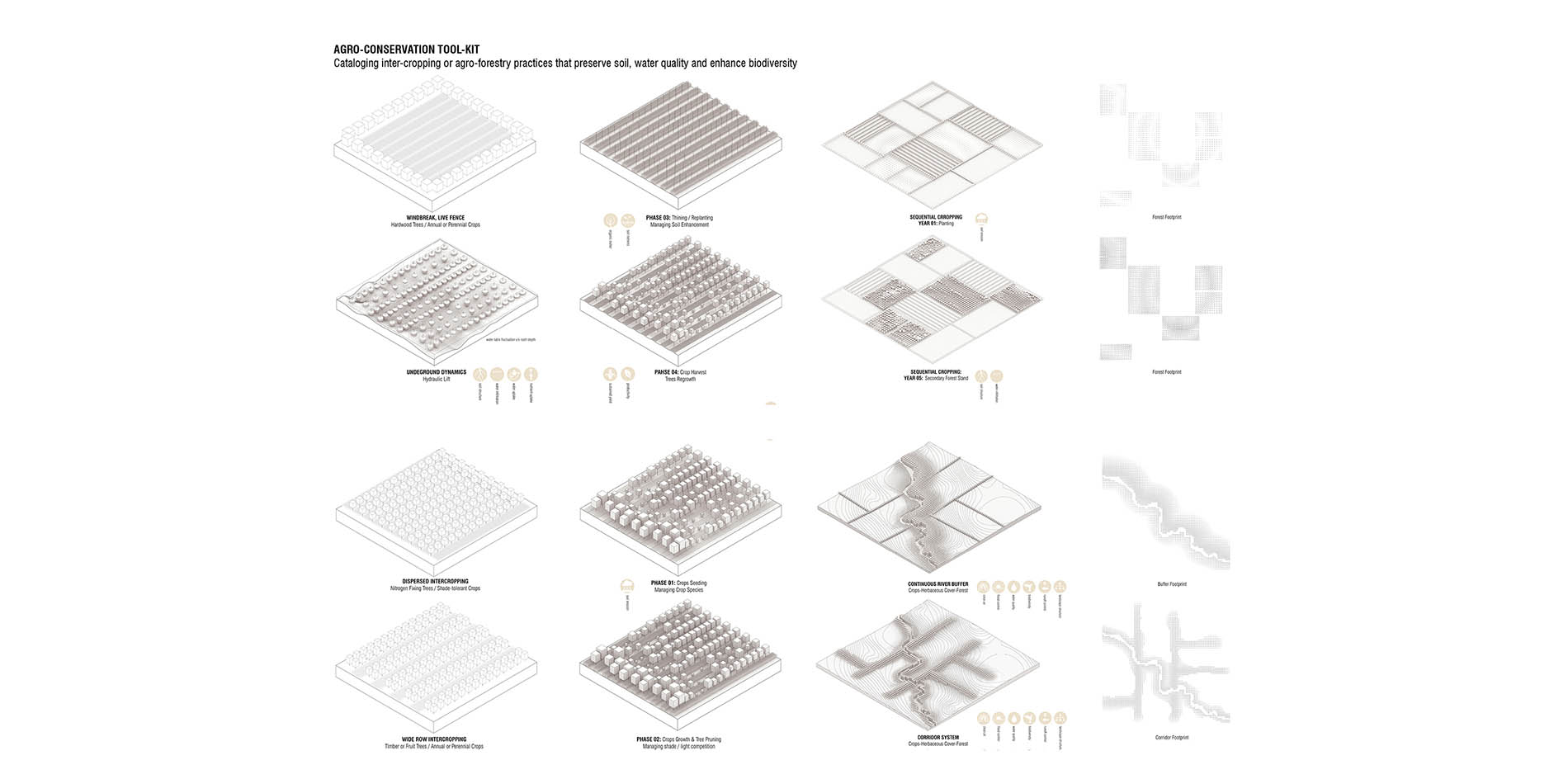
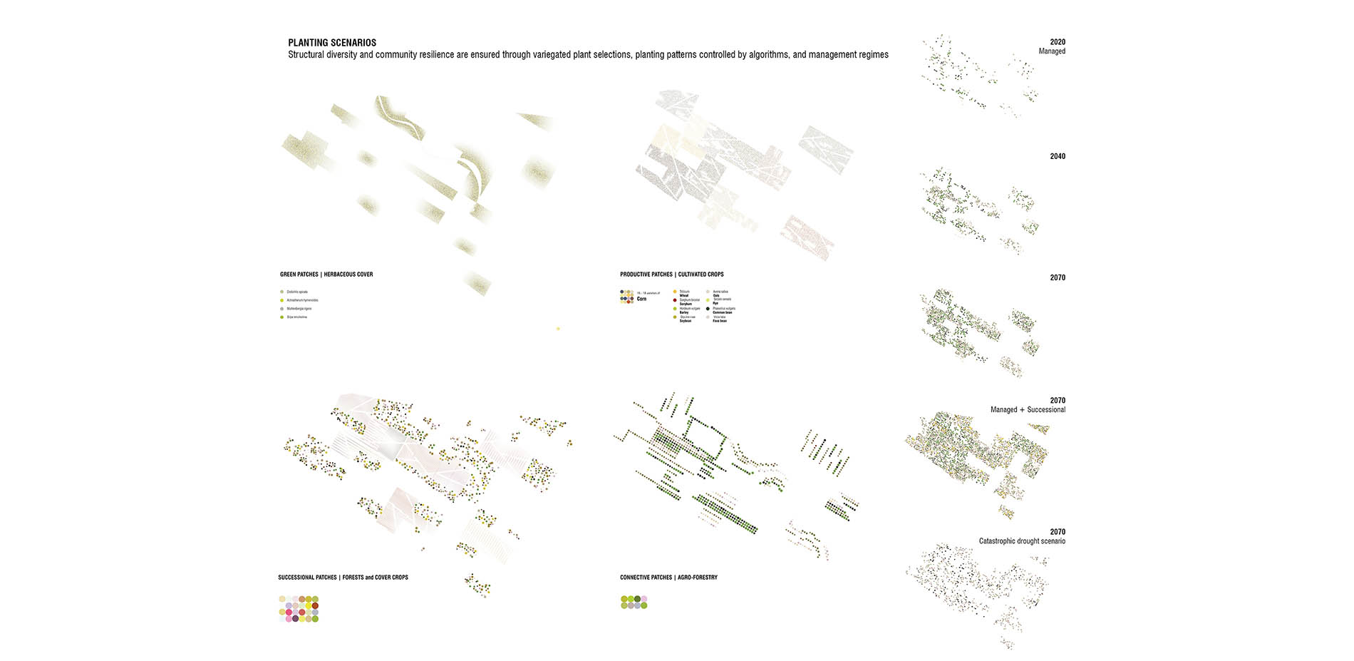
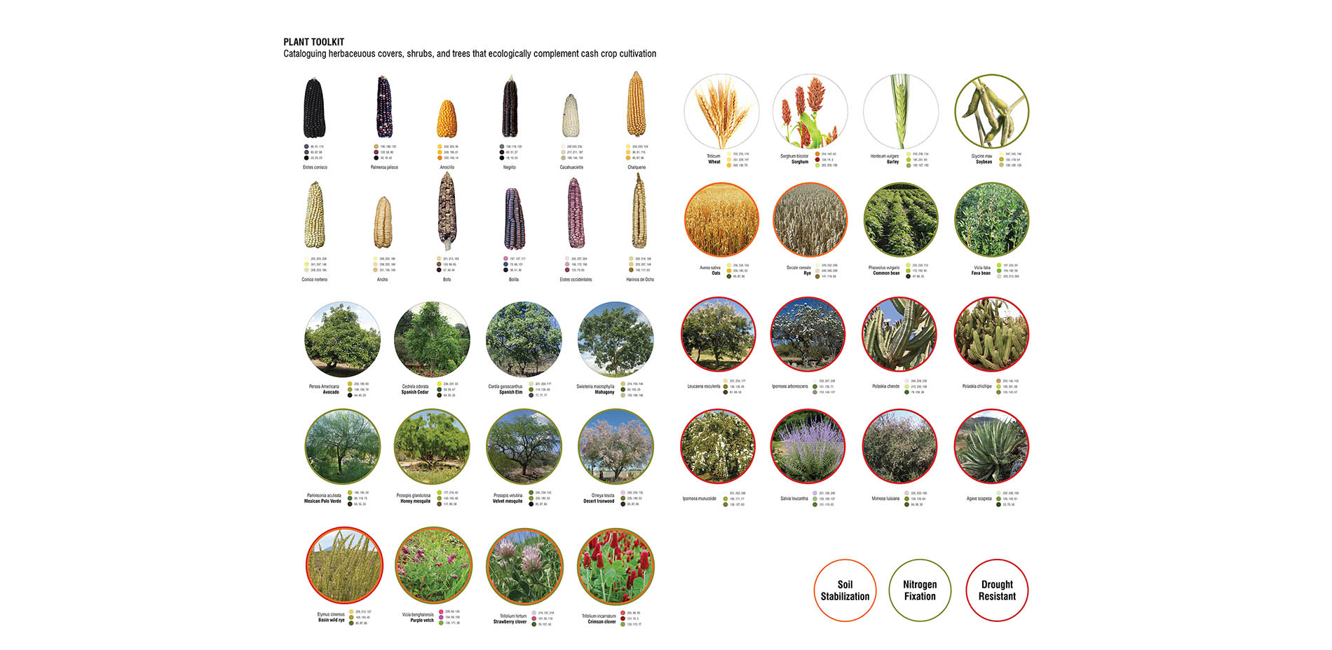
Literature in agro-forestry, inter-cropping, no-till agriculture and other ecological techniques was studied in detail to identify best practices and understand plant-crop relationships that enhance primary productivity through nitrogen-fixation, hydraulic lift, and soil conservation. A plant list specific to the Mexico region was drawn up with structural diversity and performative heterogeneity in mind. A list of drought-resistant species were identified along with nitrogen-fixing and soil-stabilizing trees, shrubs, crops, and herbaceous covers. Agro-conservation techniques were understood and classified in performative terms and scalability. The spatial implications of inter-cropping, rotational cropping, and agro-forestry techniques was diagrammed to give us a structure for organizing the plant species such as cover crops, trees, and shrubs with cash crops.
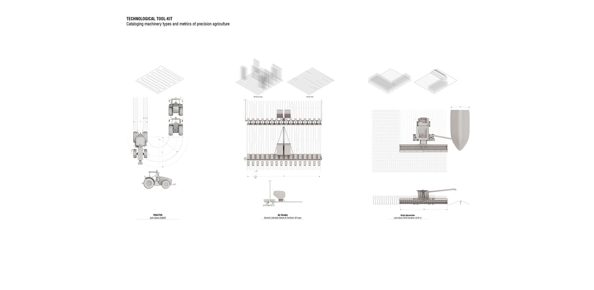
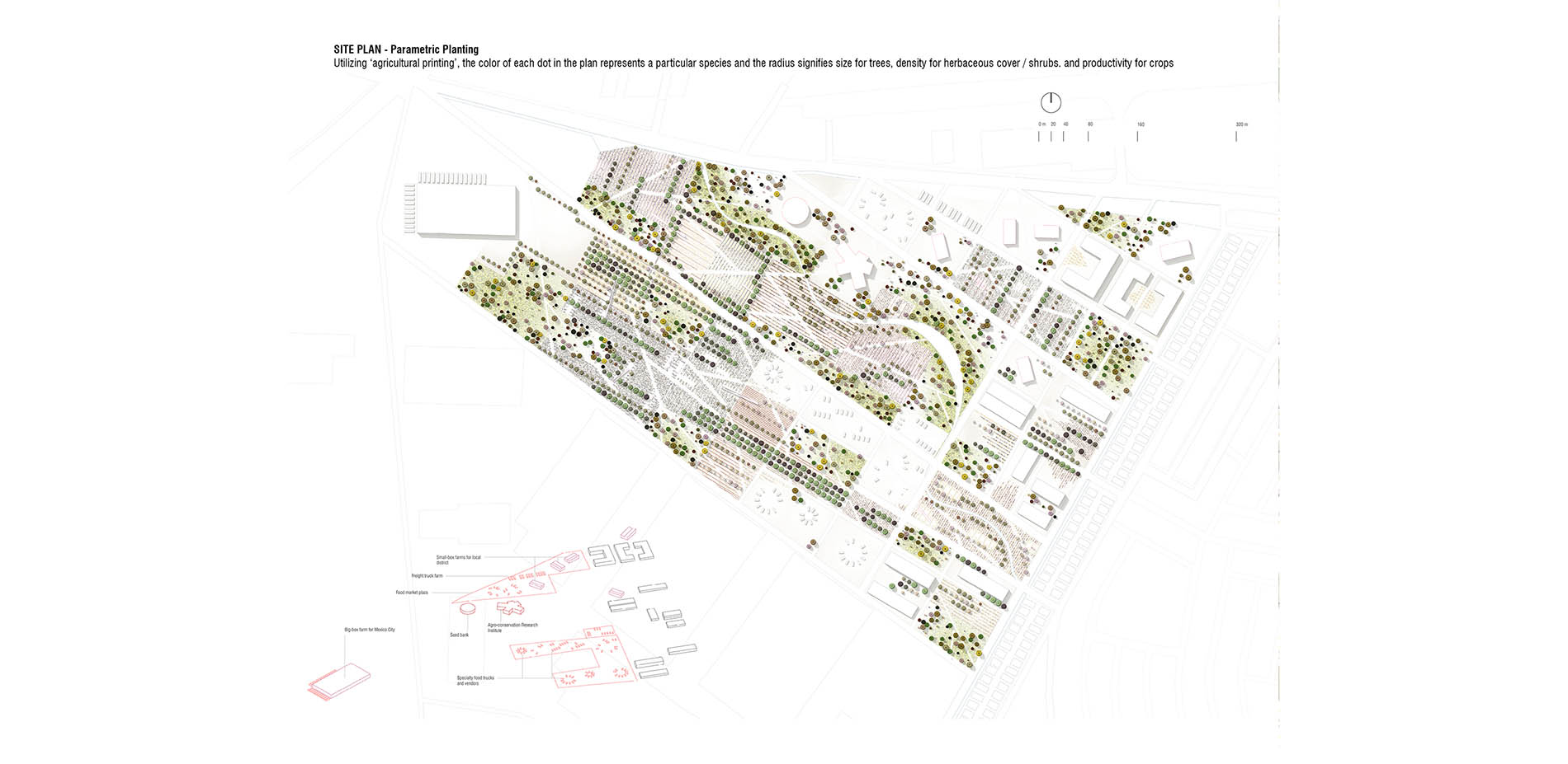
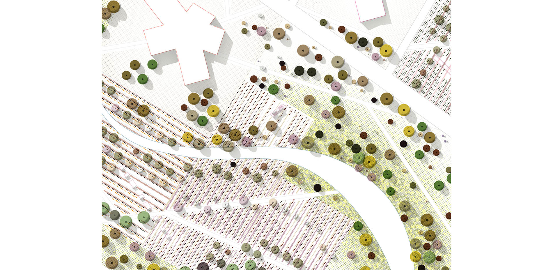
A close study of precision-agriculture was conducted to reveal the metrics of surveillance resolution as well as the dimensions of machinery like seeders, harvesters, and irrigators from which multiple spatial variations can be devised. Thus, ‘agricultural printing’ or the precise distribution of multiple seeds through standard machines controlled by algorithms reinvents agro-conservation techniques from a labor-intensive process to one that can be achieved through standard machines. The synthesis of plant lists, agro-conservation techniques and precision agriculture metrics allowed us to create an algorithm that specified the species, location, density, and size of each planting within an agricultural plot.
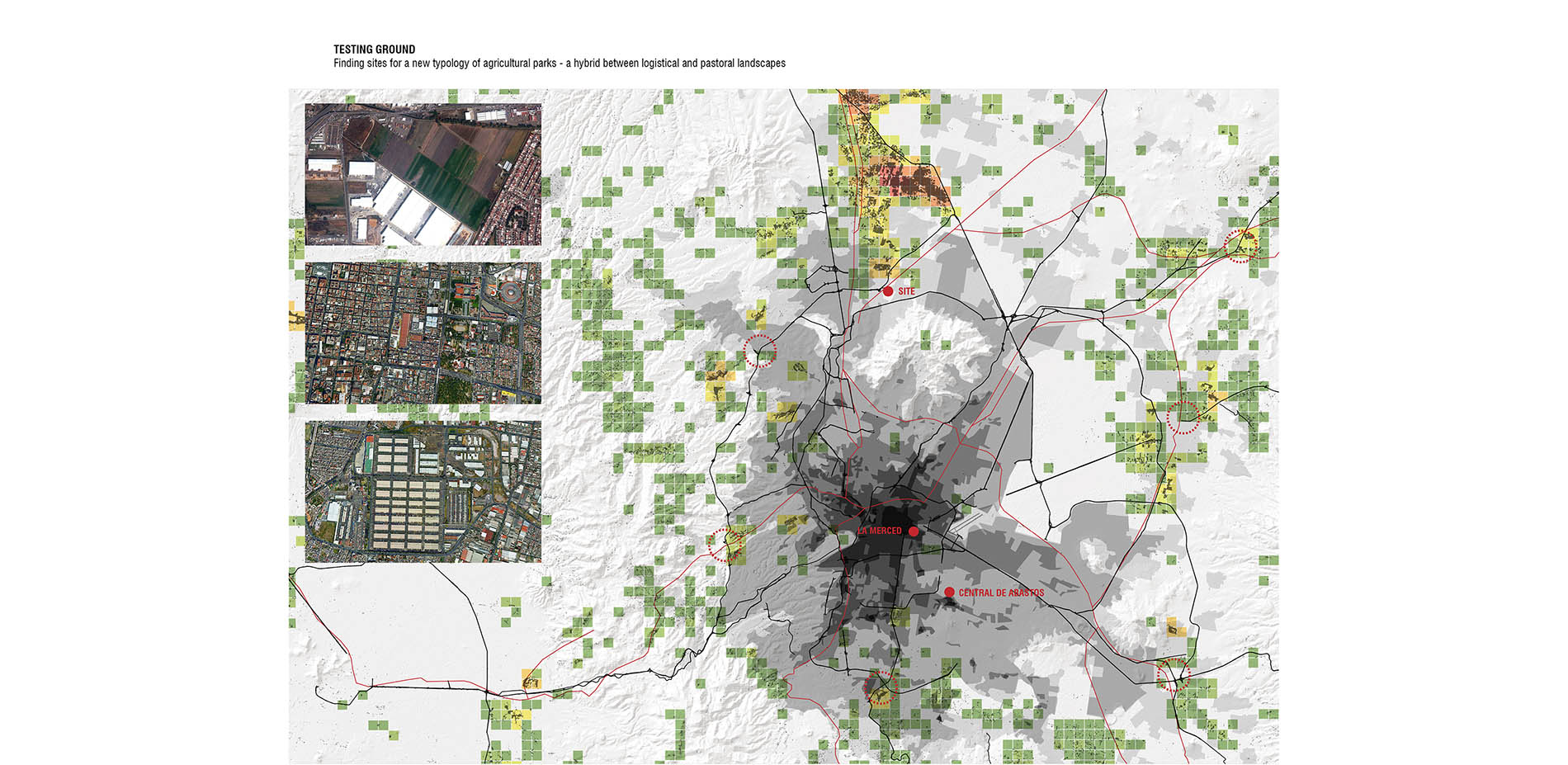
At the same time, we recognized the exponential advent of post-soil agriculture – where aquaponics and aeroponics in closed controlled systems allows food production to shift into compact boxes in urban environments or big-box production centers in the suburbs. Our project tests the spatial manifestations of both these technological developments in the form of an agricultural park typology – a new future typology where big-box, small-box agriculture co-exist with precision agriculture fields, creating a food hub for a larger region while producing a place of ecological and cultural value for the suburban Mexico City. A remote-sensing analysis of Mexico City region revealed a series of sites where urban footprint, agricultural fields, and logistical landscapes intersect. We chose a rapidly transforming agricultural area about to be consumed by big-box development and suburbanization as a site for testing precision conservation at an urban scale.
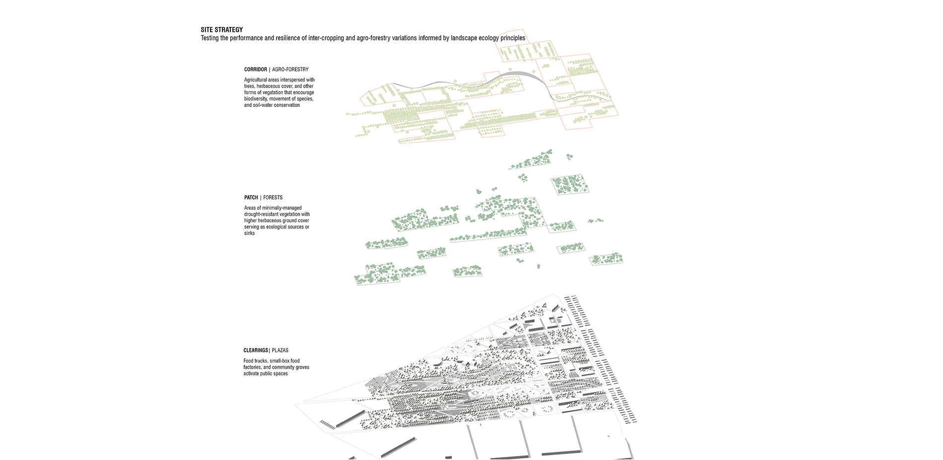
The site is a testing ground for the following parameters: the potential of precision agriculture to create structural diversity, the performative benefits to production and ecosystems, and the ability for agro-forests to act as corridors between forested patches. The plots were divided into forested zones that would be minimally managed, agricultural fields that would test out variations of agro-conservation, and public spaces activated by small/big-box food production/distribution units. An algorithm was set up to assign specific species to specific zones within the metrics of agricultural machinery. Representatively, a color palette was set up to link each species to a unique RGB code and the radius of the species as circles varied to represent size for trees, density for herbaceous cover / shrubs, cover crops and productivity for cash crops. The algorithm can change with shifting cycles of ecological or economic needs. Structural diversity and landscape resilience are ensured through variegated plant selections, and planting patterns controlled by the algorithm. It can be modified to create new clearings and spatial experiences, in which texture, color and sectional qualities shift every harvest cycle. This creates a uniquely dynamic landscape that is constantly worked upon – allowing design to bring together conservation concerns with productive working landscapes.
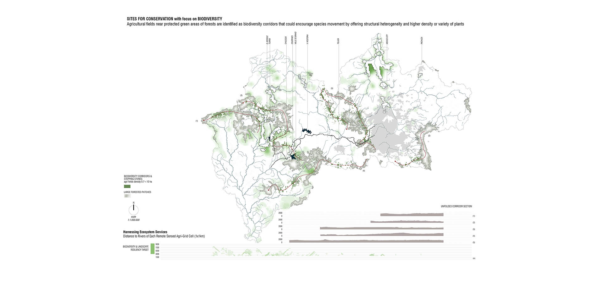
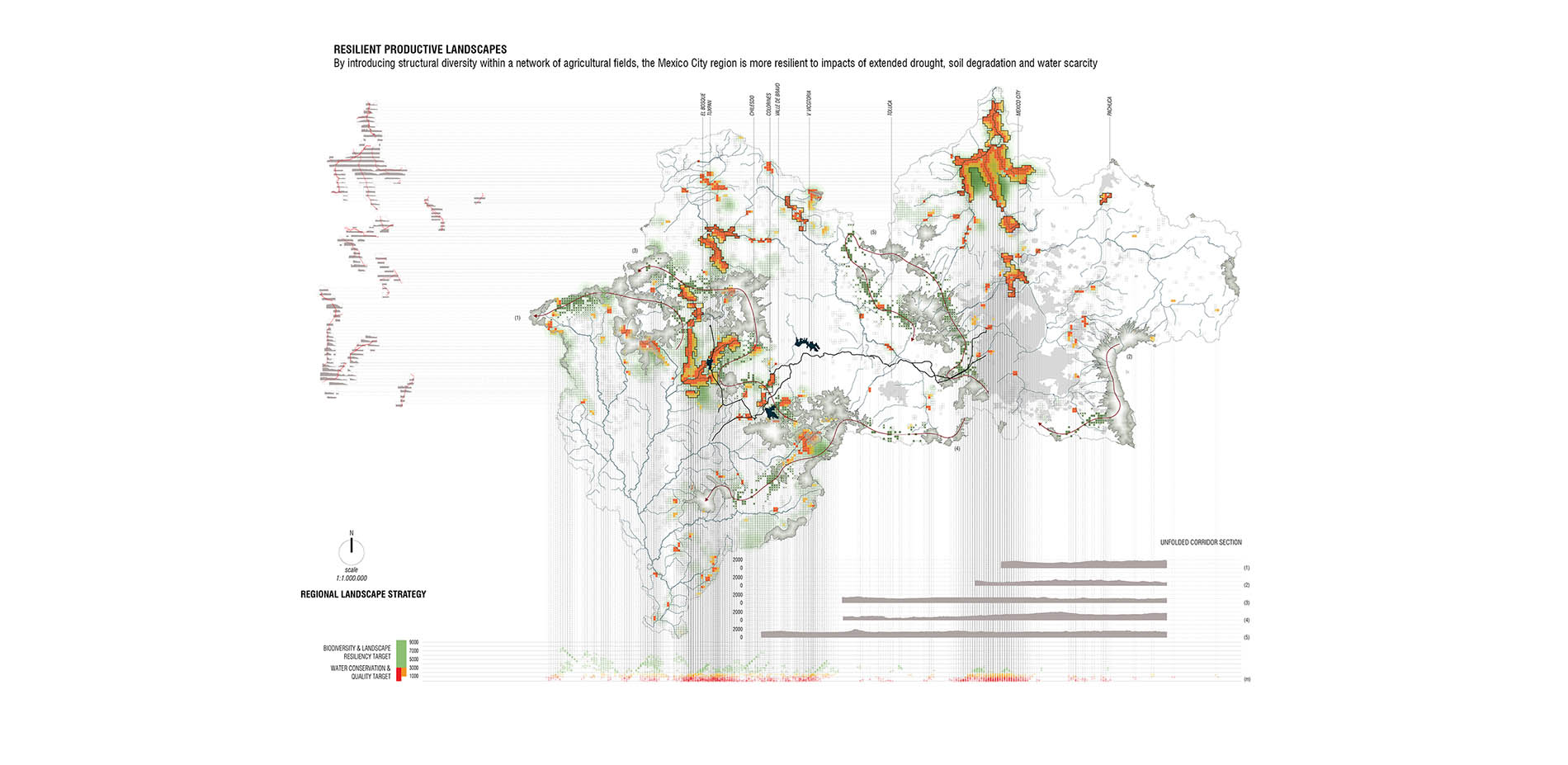
In the regional scale, remote sensing and proximity-suitability analysis allowed us to specify high-priority agricultural fields that could be influenced by government policy or land trusts to engage in specific ecological goals. Agricultural sites within 3500 m of important water sources such a primary reservoirs would become targets for controlling runoff and engage in riparian agro-forestry techniques with higher herbaceous ground cover. Agricultural sites near protected green areas of forests are identified as biodiversity corridors that could encourage species movement by offering structural heterogeneity and higher density or variety of plants. Management techniques ensure the progression of plant communities towards greater resilience to drought. Thus, by introducing structural diversity within a network of agricultural fields, the Mexico City region is more resilient to impacts of extended drought, soil degradation and water scarcity, while maintaining agricultural productivity and economies.